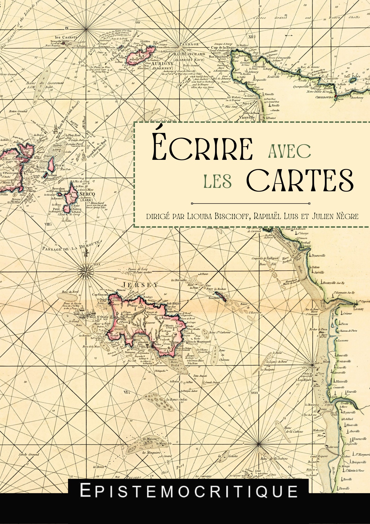
Études réunies par
Liouba Bischoff, Raphaël Luis et Julien Nègre
ISBN numérique PDF : 979-10-97361-11-2
Table des matières et résumés
1. Introduction
Liouba Bischoff, Raphaël Luis et Julien Nègre
2. « La vue à vol d’oiseau de l’homme » : usages génétiques de la carte et mise en récit dans Les Travailleurs de la mer de Victor Hugo (1866)
Delphine Gleizes
Mots-clés : Victor Hugo, Cartes, Cartographie, Dessins, Manuscrits, Génétique textuelle, Océan, Roman
Keywords: Victor Hugo, Maps, Cartography, Drawings, Manuscripts, Textual genetics, Ocean, Novel
Résumé : si l’imagination de Victor Hugo est très largement visuelle, ainsi qu’en témoignent les milliers de dessins produits par l’écrivain, elle est aussi géométrique et topographique. L’appréhension de l’espace est chez lui un puissant accélérateur de la créativité littéraire. Cette contribution étudie la façon dont la représentation cartographique engendre l’univers littéraire et structure l’imagination romanesque en s’attachant au cas particulier du roman Les Travailleurs de la mer. Pour écrire son œuvre, Hugo a recours à une carte anglaise qui lui permet de fortifier la dimension documentaire du texte. Mais il réalise lui-même des croquis cartographiques dans des carnets de travail. Les scénarios romanesques se trouvent ainsi mis à l’épreuve de l’espace cartographié qui permet d’en mesurer l’efficacité ou, le cas échéant, par rétroaction, d’en améliorer la cohérence. Outil d’intellection du monde, la carte devient symptomatique de cette « vue à vol d’oiseau » qui s’affirme comme un trait structurant de l’esthétique et de la pensée hugoliennes. La carte est tout à la fois relevé des accidents du monde et tentative synthétique pour en révéler la possible portée symbolique. En parcourant l’espace au fil des tracés cartographiques réalisés à main levée, l’écrivain ne reproduit pas les cartes contemporaines. Il se les réapproprie en leur faisant subir un ensemble de déformations commandées par des raisons tout à la fois scénaristiques, philosophiques, politiques et affectives. L’article cherche à apprécier les liens entre espace géographique et espace romanesque sans rapporter strictement l’un à l’autre mais en mesurant au contraire le travail créatif de l’écrivain et les effets de déformation et d’anamorphose à l’œuvre dans l’espace génétique des manuscrits.
Abstract: while Victor Hugo’s imagination was largely visual, as evidenced by the thousands of drawings he produced, it was also geometric and topographical. Hugo’s apprehension of space is a powerful gas pedal of literary creativity. This contribution examines the way in which cartographic representation generates the literary universe and structures the novelistic imagination, focusing on the particular case of the novel Les Travailleurs de la mer. To write his work, Hugo uses an English map, which strengthens the documentary dimension of the text. But he also made his own cartographic sketches in notebooks. In this way, his novelistic scenarios were put to the test of cartographic space, enabling him to measure their effectiveness or, where necessary, improve their coherence through feedback. As a tool for intellection of the world, the map becomes symptomatic of the “bird’s-eye view” that is a defining feature of Hugolian aesthetics and thought. The map is both a record of the world’s accidents and a synthetic attempt to reveal their possible symbolic significance. In traversing space through freehand cartographic tracings, the writer does not reproduce contemporary maps. The map is both a record of the world’s accidents and a synthetic attempt to reveal its possible symbolic significance. By traversing space along freehand cartographic lines, the writer does not reproduce contemporary maps. Rather, he reappropriates them by subjecting them to a series of distortions dictated by reasons that are at once scenic, philosophical, political and affective. This article seeks to appreciate the links between geographical space and novelistic space, without strictly relating one to the other, but rather by measuring the writer’s creative work and the effects of distortion and anamorphosis at work in the genetic space of his manuscripts.
3. Les trésors de la carte : explorations cartographiques et intrigue aventureuse chez R. L. Stevenson et H. G. Wells
Julie Gay
Mots-clés : carte, géographie, récit, aventure, géopoétique, Stevenson, Wells, îles.
Keywords: map, geography, narrative, adventure, geopoetics, Stevenson, Wells, islands.
Résumé : objet de fascination émerveillée pour le voyageur, la carte constitue en premier lieu un outil indispensable à l’exploration géographique, en particulier celle de terres lointaines ou inconnues. Rien d’étonnant alors à ce qu’elle soit un objet central au sein des récits d’aventures géographiques, où elle apparaît parfois comme un contrepoint visuel au texte. Toutefois, à la précision a priori scientifique de ce mode de figuration du monde se substituent dans certains récits d’aventures des cartes incomplètes, floues ou poétiques, en particulier au tournant du siècle.
Cet article se propose donc d’étudier la façon dont Stevenson et Wells s’emparent de ce topos du récit d’aventures pour en faire non seulement l’embrayeur du voyage et de l’aventure mais aussi un élément crucial dans le déroulement et la structure de l’intrigue, en particulier dans Treasure Island de Stevenson, ainsi que dans « The Treasure in the Forest » d’H. G. Wells. Nous analyserons la façon dont l’intrigue se construit à partir de la carte, qui en vient à « faire événement ». Il s’agira de comprendre comment le brouillage des repères cartographiques donne naissance à une nouvelle forme d’aventure, qui ne réside plus tant dans la chasse au trésor que dans l’exploration des dessous de la carte. Nous nous efforcerons enfin de déterminer dans quelle mesure cet effort herméneutique donne lieu à une réflexion sur le processus de lecture et sur le texte en tant que mode de représentation géographique, dont la spatialité fait écho à celle de la carte sans toutefois s’y superposer complètement.
Abstract: an object of fascination and wonder for the traveller, the map is first and foremost an indispensable tool for geographical exploration, particularly of distant or unknown lands. It is hardly surprising, then, that maps are central to tales of geographical adventure, sometimes appearing as a visual counterpoint to the text. However, the assumed scientific precision of this way of depicting the world is replaced in some adventure stories by incomplete, blurred, or poetic maps, particularly at the turn of the century.
In this article, we look at how Stevenson and Wells use this topos of adventure storytelling to make it not only the focus of travel and adventure, but also a crucial element in the development and structure of the plot, particularly in Stevenson’s Treasure Island and H. G. Wells’ “The Treasure in the Forest.” We analyze how the plot is built around the map, which becomes an « event ». The aim is to understand how the blurring of cartographic reference points gives rise to a new form of adventure, which becomes an exploration of the underside of the map rather than a treasure hunt per se. Finally, we explore the extent to which this hermeneutic effort gives rise to a reflection on the process of reading and on the text as a mode of geographical representation, whose spatiality echoes that of the map without, however, completely superimposing it.
4. L’ouverture par les cartes dans les récits réalistes et les fables de Rudyard Kipling
Élodie Raimbault
Mots-clés : Rudyard Kipling, carte, géographie, cartographie, géopoétique
Keywords: Rudyard Kipling, map, geography, cartography, geopoetics
Résumé : dans l’œuvre de Rudyard Kipling, l’imaginaire cartographique est structurant et fécond. Afin de rendre compte des divers usages de la carte dans son œuvre, cet article considère trois types de cartes en particulier : la carte ajoutée par les éditeurs en annexe du récit pour aider le lecteur ; celle qui est créée par l’auteur, comme avant-texte ou comme illustration, et dont le lien avec le récit est plus intime ; et enfin celle créée par un personnage dans la diégèse et reproduite en regard du récit où figure ce personnage. Kipling fait des cartes des outils pour construire la référentialité de l’espace littéraire et des représentations mentales orientées par une vision coloniale du territoire, élaborant ainsi un espace de création qui permet à la fiction de se déployer. En observant comment ces cartes jouent avec les codes de la cartographie, cette étude cherche à comprendre comment la carte kiplingienne parvient à représenter l’espace du divers et du vagabondage alors même qu’elle évoque formellement un contexte colonial, dans lequel la carte est un outil de catégorisation, en apparence peu susceptible d’amener une ouverture. Ses cartes ne prétendent pas être scientifiques ; elles jouent avec la frontière entre réalité et fiction et sur les conventions des récits de voyage et d’aventure ; elles provoquent un questionnement sur les frontières du texte de fiction, en ouvrant le texte à un foisonnement de micro-récits supplémentaires.
Abstract : in Rudyard Kipling’s work, the cartographic imagination is both structuring and fertile. In order to account for the various uses of maps in his work, this article considers three types of maps in particular: the map added by the editors as an appendix to the narrative to help the reader; the map created by the author, as foretext or illustration, and whose link with the narrative is more intimate; and finally, the map created by a character in the diegesis and reproduced opposite the narrative in which that character appears. Kipling uses maps as tools to construct the referentiality of literary space and mental representations oriented by a colonial vision of the territory, thus elaborating a creative space that allows fiction to unfold. By observing how these maps play with the codes of cartography, this study seeks to understand how the Kiplingian map manages to represent the space of diversity and vagrancy, even as it formally evokes a colonial context, in which the map is a tool of categorization, seemingly unlikely to lead to openness. These maps do not claim to be scientific; they play with the boundary between reality and fiction, and with the conventions of travel and adventure narratives; they provoke a questioning of the boundaries of the fictional text, opening it up to an abundance of additional micro-narratives.
5. Cartographismes : Peter Sís ou l’imagier des espaces
Christophe Meunier
Mots-clés : capital spatial, album-géographe, iconotexte, acte d’image, carte
Keywords: spatial capital, geographer’s book, iconotext, image act, map
Résumé : le regard d’artiste que Peter Sìs porte sur le monde est un regard de cartographe, celui d’un rêveur aux yeux grand ouverts, qui dessine le monde, l’arrange, l’organise à sa convenance. Sìs aime jouer avec les différentes échelles, proposer des représentations différentes des espaces parcourus et habités par ses personnages. À chaque représentation semble correspondre une fonction dans le récit. Planter le décor, organiser les espaces, sa propre mémoire, mesurer un parcours sont tour à tour ou simultanément convoqués dans les cartes ou les vues obliques, offrant ainsi aux lecteurs une configuration générale des espaces où se déroule l’action. À l’intérieur de ces espaces, l’identification de lieux est importante pour Sìs. Ils sont chargés de sens, d’histoire(s) et de valeurs. Ils permettent aux personnages diégétiques de se repérer dans le parcours que l’auteur leur fait suivre, de structurer un espace généré par le récit.
Établissant une interdépendance avec le texte qui la borde ou qu’elle contient, la carte est, chez Peter Sìs, artialisée. Elle constitue un instrument et un indicateur de spatialité. Représentation graphique hautement semiotisée, elle prend des formes hybrides proposant à la fois une organisation générale d’espaces très souvent vastes ; mais aussi l’expression en un lieu d’une « condensation sociale et spatiale » particulière. Ce sont ces deux formes de graphismes qui seront analysées dans cet article en me posant la question de leur fonction dans le récit iconotextuel.
Abstract: as an artist, Peter Sìs looks at the world through the eyes of a cartographer, a wide-eyed dreamer who draws, arranges, and organizes the world as he sees fit. Sìs likes to play with different scales, offering different representations of the spaces traveled and inhabited by his characters. Each representation seems to correspond to a function in the story, such as setting the scene, organizing spaces or one’s own memory, measuring a journey. These different functions appear in turn or simultaneously in the maps or oblique views included in his books, offering readers a general configuration of the spaces where the action takes place. Within these spaces, the identification of places is important to Sìs. They are charged with meaning, history, stories, and values. They enable the diegetic characters to find their bearings in the path the author has them follow, to structure a space generated by the narrative.
Establishing an interdependence with the text that borders it or that it contains, the map is, for Peter Sìs, artialized. It is an instrument and indicator of spatiality. A highly semiotized graphic representation, it takes on hybrid forms, offering both a general organization of often vast spaces, and the expression in one place of a particular “social and spatial condensation.” These two graphic forms are analyzed in this article, with a focus on their function in the iconotextual narrative.
6. Tentative d’inventaire d’une carte inventée : Description d’Olonne de Jean-Christophe Bailly
Aurélien d’Avout
Mots-clés : Bailly, plan, carte, fiction, géographie littéraire, génétique des textes, relation texte-image
Keywords: Bailly, plan, map, fiction, literary geography, textual genetics, text-image relationship
Résumé : loin de faire figure de simple ornement, le plan de la ville accompagnant Description d’Olonne (Bailly, 1992) jouit d’un statut singulier : dessiné par l’auteur, il constitue l’embrayeur même du récit, le socle graphique à partir duquel l’écriture se déploie. L’article analyse d’abord la place que cette image occupe dans le dispositif éditorial du livre et le rôle qu’elle joue dans l’acte de lecture. La genèse du plan révèle quant à elle le surcroît graphique du dessin original par rapport au dessin publié, donnant à penser l’inachèvement nécessaire du récit qui a pour vocation d’en décrire les formes. Du faisceau de représentations dont Olonne est l’objet, le plan se distingue par son potentiel heuristique et s’impose comme une précieuse clé d’interprétation du texte.
Abstract: Far from being a mere ornament, the city map accompanying Description d’Olonne (Bailly, 1992) enjoys a singular status: drawn by the author, it is what sets the narrative in motion — the graphic foundational element from which the writing unfolds. This article analyzes the place this image occupies in the book and the role it plays in the act of reading. A study of how the plan was drawn reveals the additions included in the original drawing compared to the published one, suggesting the necessary incompleteness of the narrative whose purpose is to describe its shape. Among the many representations of Olonne, the plan stands out for its heuristic potential, providing a valuable key to interpreting the text.
7. Faire le tour du propriétaire : défamiliariser le chez soi selon Thomas Clerc et Christophe Boltanski
Laurent Demanze
Mots-clés : autoportrait, défamiliarisation, ludique, plan.
Keywords: self-portrait, defamiliarization, playfulness, plan.
Résumé : si les récits intégrant des cartes sont nombreux dans une littérature contemporaine qui emboîte le pas au spatial turn, Thomas Clerc dans Intérieur et Christophe Boltanski dans La Cache insèrent des plans de leurs appartements. Les plans structurent le texte et rejouent en mineur dans ces récits de l’enfermement le motif d’une odyssée, mais intime, reconfigurant le parcours spatial pour défamiliariser et inquiéter l’identité. Les plans mobilisés autorisent une lecture ludique des textes, invitant la lectrice et le lecteur à des parcours d’appropriation, selon des lignes traversières, contrevenant à la linéarité du récit. Pour autant, si ces portraits d’appartement semblent dessiner des autoportraits, il s’agit là, selon l’hypothèse de Michel Beaujour dans Miroirs d’encre, d’autoportraits impersonnels : le lieu habité fonctionne comme un fonds rhétorique, où les citations et les références sont disposées pour être remobilisées, constituant un espace collectif plus que singulier.
Abstract: while there are many stories incorporating maps in contemporary texts that position themselves in the continuity of the spatial turn, Thomas Clerc’s Intérieur and Christophe Boltanski’s La Cache include maps of their apartments. In these tales of confinement, maps structure the text and replay the motif of an odyssey, albeit an intimate one, reconfiguring the spatial journey to defamiliarize and unsettle identity. The plans allow for a playful reading of the texts, inviting the reader to appropriate them along cross-cutting lines that counter the linear nature of the narrative. And yet, if these apartment portraits appear to be self-portraits, they are, according to Michel Beaujour’s hypothesis in Miroirs d’encre, impersonal self-portraits: the inhabited place functions as a rhetorical fountainhead, where quotations and references are arranged to be remobilized, constituting a collective rather than a singular space.
8. Récits d’aventure et matérialité de l’objet-livre : usages ludiques de la carte dans trois romans américains contemporains
Gaëlle Debeaux
Mots-clés : fictions multimodales, post-postmodernisme, intrigue, ludique, intermédiatique, roman contemporain, roman américain.
Keywords: multimodal fictions, post-postmodernism, intrigue, playfulness, intermediality, contemporary novel, American novel.
Résumé : cet article explore l’usage que font trois romans américains récents de la carte, à partir d’un point commun consistant, pour ces trois œuvres (Larsen, 2009 ; Dodson, 2015 ; Dorst/Abrams, 2013), à exploiter le livre comme un espace où l’écriture mais aussi l’illustration se déploient au-delà du cadre convenu du corps de page. Si les cartes ne sont pas également présentes dans ces trois romans, elles servent des enjeux similaires : elles témoignent d’un rapport au monde des personnages, tout en permettant au lecteur de suivre leurs aventures à travers les espaces parcourus ; elles peuvent alors aller jusqu’à réactiver le motif de la carte au trésor au sein de fictions présentant un modèle de lecteur-aventurier ou explorateur. Ainsi, l’usage de la carte s’inscrit au sein d’une stratégie générale d’exploitation des potentialités de l’objet-livre, plaçant le lecteur dans une posture active relevant du paradigme de l’enquête. En présentant des personnages voyageurs arpentant des espaces inconnus, ces trois romans réactualisent également le modèle du récit d’aventure et son rapport au territoire, par le geste cartographique pris en charge par les personnages eux-mêmes. Dans cette perspective, on s’interroge sur le discours que ces cartes et leurs usages dans la fiction et au-delà permettent de tenir sur les espaces réels ainsi représentés.
Abstract: this article explores the use of maps in three recent American novels (Larsen, 2009; Dodson, 2015; Dorst/Abrams, 2013) whose common feature is to use the physical space of the book to expand the narrative and the illustrations far beyond the conventional framework of the page. Although maps are not equally present in these three novels, they serve similar purposes: they testify to the characters’ relationship with the world, while enabling the reader to follow their adventures; they can go as far as to reactivate the treasure map motif within fictions presenting a reader-adventurer or explorer model. In this way, the use of the map is part of a general strategy of exploiting the potential of the book-as-object, placing the reader in an active posture similar to the paradigm of detective fiction. By presenting travelling characters surveying unknown spaces, these three novels also update the model of the adventure story and its relationship to the territory, through the cartographic gesture performed by the characters themselves. This raises the question of what these maps have to say about the real places they represent.
9. Cartographies d’outre-tombe : la postérité cartographique de la Nouvelle-Angleterre imaginaire de Lovecraft
Henri Desbois
Mots-clés : H. P. Lovecraft, Nouvelle-Angleterre, cartographie, fantastique, diplotopie.
Keywords: H. P. Lovecraft, New England, cartography, weird fiction, diplotopia.
Résumé : P. Lovecraft (1890-1937) a créé dans ses récits d’horreur une géographie parallèle de la Nouvelle-Angleterre, où des localités imaginaires comme Arkham ou Innsmouth côtoient des lieux réels. Les continuateurs de son œuvre ont repris et étendu son imaginaire non seulement dans le domaine littéraire, mais aussi dans le cinéma, la bande dessinée, et le jeu de rôle. C’est surtout dans ce dernier domaine que des cartes de la géographie lovecraftienne ont été produites en grand nombre. Je propose d’examiner comment ces cartes s’articulent avec la fiction de Lovecraft, en étudiant plus particulièrement le court roman Le Cauchemar d’Innsmouth.
Je suggère que les cartes peuvent être regroupées en trois catégories, selon la fonction qu’elles remplissent, et selon leur style graphique. Cette abondante production cartographique produit des effets à la fois sur notre lecture de Lovecraft, et sur notre perception des espaces réels.
Abstract: in his horror stories, H. P. Lovecraft (1890-1937) created a parallel geography of New England, where imaginary places like Arkham and Innsmouth are contiguous with real ones. Continuers of his work have taken up and extended his imagination not only in literature, but also in film, comics and role-playing games. It is especially in the latter field that maps of Lovecraft’s geography have been produced in large numbers. I propose to examine how these maps relate to Lovecraft’s fiction, with particular reference to the short novel The Shadow over Innsmouth.
I suggest that these maps can be grouped into three categories, according to the function they perform and their graphic style. This abundant cartographic production affects both our reading of Lovecraft, and our perception of real spaces.
10. La matrice des cartes dans Atlas der abgelegenen Inseln de Judith Schalansky
Mandana Covindassamy
Mots-clés : Judith Schalansky, insulaire, Atlas der abgelegenen Inseln, cartographie et littérature, typographie, histoire du livre, sémiologie graphique, narration, littérature de langue allemande.
Keywords: Judith Schalansky, isolario, Atlas der abgelegenen Inseln, cartography and literature, typography, book history, graphic semiology, narrative, German-language literature.
Résumé : avec son Atlas des îles abandonnées (Schalansky, 2009), Judith Schalansky réinvente l’insulaire et revisite l’atlas. Écrivaine, mais aussi conceptrice de livre, elle y crée un dispositif graphique qui reconfigure ces genres hérités de l’histoire du livre, allant jusqu’à dessiner elle-même les cartes des îles. Né de la culture cartographique de l’autrice, cet ouvrage propose un choix subjectif d’une cinquantaine d’îles dont l’unique point commun est leur éloignement – mais d’où ? Pour déjouer la visée objective propre au genre de l’atlas, Schalansky opère un choix fondé sur la connaissance de la répartition des îles sur le globe rendue possible par le savoir cartographique, véritable matrice de l’ouvrage. Porté par une visée éthique explicite, l’atlas de Schalansky procède à une remise en question des dichotomies centre-périphérie, nature-culture, vérité-fiction, homme-animal en réintroduisant une perspective subjective dans le genre de l’atlas.
Le présent article propose dans un premier temps de relire l’atlas de Schalansky à l’aune de la tradition dont il est issu et qu’il subvertit (insulaire, atlas) ; il analyse ensuite de manière détaillée comment le dispositif graphique conçu par Schalansky relève de la narration, allant jusqu’à inscrire la forme du globe dans celle du livre, à rendre l’histoire de la conquête du monde par les Européens palpable dans le choix des matériaux ou de la police de caractère, à déjouer l’horizon d’attente cartographique des lecteurs ; enfin, il met en évidence la matrice proprement cartographique des récits, inspirés par une poétique du toponyme chargé d’histoire.
Abstract: with her Atlas of Remote Islands, Judith Schalansky reinvents the isolario, or book of islands, and revisits the format of the atlas. Both a writer and a book designer, she creates a graphic device that reconfigures these genres, even going so far as to draw the maps of the islands herself. Born from the author’s cartographic culture, this book offers a subjective selection of around fifty islands whose only common feature is their remoteness – but from where? Schalansky’s choice is based on her knowledge of the distribution of islands around the globe, made possible by cartographic knowledge, the true matrix of the book. Structured by her explicit ethical stance, Schalansky’s atlas challenges dichotomies such as center-periphery, nature-culture, truth-fiction and man-animal, reintroducing a subjective perspective to the atlas genre.
This article begins by re-reading Schalansky’s atlas in terms of the tradition from which it derives and which it subverts (the isolario, the atlas). It then analyses in detail how Schalansky’s graphic device is part of her narrative, going so far as to inscribe the shape of the globe into that of the book, making the history of the conquest of the world by the Europeans palpable in the choice of materials or typeface, and thwarting the reader’s cartographic expectations. Finally, the article highlights the specifically cartographic matrix of the narratives, inspired by a poetics of toponymy charged with history.
11. Les voyages d’Olivier Hodasava : le globe virtuel de Google, une machine à fabriquer des histoires
Nathalie Gillain
Mots-clés : littérature contemporaine, cartographie, photographie, encyclopédisme, microfiction.
Keywords: contemporary literature, cartography, photography, encyclopedism, microfiction.
Résumé : en 2010, Olivier Hodasava, l’un des membres fondateurs de l’Ouvroir de Cartographie Potentielle (OuCarPo), se lance dans la création d’un blog, Dreamlands Virtual Tour, qu’il présente comme un carnet de voyage autour du monde. À l’aide du service de navigation virtuelle Google Street View, il entreprend en effet d’explorer les quatre coins de la planète. Quotidiennement, il partage les images réalisées au cours de ses explorations ; ce sont des captures d’écran, toujours accompagnées d’un texte : un inventaire des choses vues, un récit d’arpentage ou une microfiction. En quatorze ans, Hodasava a publié quelque trois mille comptes rendus de voyages et des dizaines de milliers d’images. Dans cet article, je propose d’appréhender le gigantisme de cette entreprise, dénotant une évidente ambition encyclopédique, par le prisme d’un récit bien connu de Borges, interrogeant la tentation de produire une « Carte Dilatée », à l’échelle 1 : 1. J’examine de quelle façon cette tentation entre en résonance avec l’entreprise photo-cartographique menée sur le blog et aussi, bien entendu, avec les multiples récits produits à partir des images collectées.
Abstract: in 2010, Olivier Hodasava, one of the founding members of the Ouvroir de Cartographie Potentielle (OuCarPo), started a blog called Dreamlands Virtual Tour, which he presents as a travel diary of a journey around the world. Using the virtual navigation service Google Street View, he sets out to explore the four corners of the planet. On a daily basis, Hodasava shares screenshots captured during his explorations, along with a short text such as an inventory of things he has seen, a survey narrative, or a short fiction. In fourteen years, Hodasava has published around three thousand travelogues and tens of thousands of images. In this article, I offer an analysis the gigantism of this project, which denotes an obvious encyclopaedic ambition, through the prism of a well-known story by Borges that questions the temptation to produce a “dilated map” at a scale of 1:1. I explore how this temptation resonates with the photo-cartographic project undertaken in the blog and, of course, with the multiple narratives based on the collected images.
Les auteurs